Milburnie Dam Removal Project
Privately-owned and on private property, Milburnie Dam - the last dam on the Neuse River between Falls Lake and the Atlantic Ocean - is slated to be removed with the next year or two by Restoration Systems and RiverBank (see their Milburnie Dam project page).
The Milburnie Dam, built in the 1850's, hasn’t been used for hydroelectric power or as a mill in many years. Through time, the falling water from the dam has churned the soil directly below the dam and created a deep pool there, causing a dangerous undercurrent. Many people have drowned just below the dam over the past few decades. The dam also prevents several species of fish, including the American shad, from continuing their swim upriver, effectively cutting off some 15 miles of habitat (to Falls Dam). Restoration Systems (Raleigh NC) and RiverBank (Austin TX) have been working through the dam removal process for more than a decade; removal is currently scheduled for 2017, but has been delayed several times before.
The Milburnie Dam, built in the 1850's, hasn’t been used for hydroelectric power or as a mill in many years. Through time, the falling water from the dam has churned the soil directly below the dam and created a deep pool there, causing a dangerous undercurrent. Many people have drowned just below the dam over the past few decades. The dam also prevents several species of fish, including the American shad, from continuing their swim upriver, effectively cutting off some 15 miles of habitat (to Falls Dam). Restoration Systems (Raleigh NC) and RiverBank (Austin TX) have been working through the dam removal process for more than a decade; removal is currently scheduled for 2017, but has been delayed several times before.
Update September 2017 - Dam Removal in Progress
|
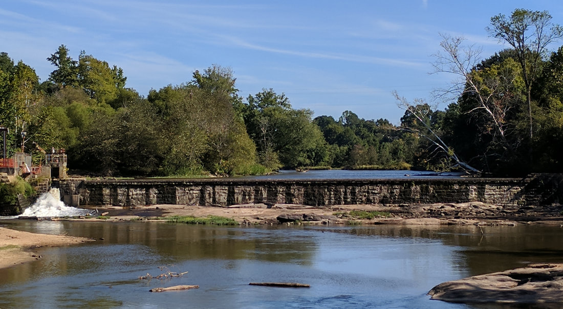
Dam removal started during September 2017 with drawdown of the water behind the dam - water is no longer flowing over the top (photo below).
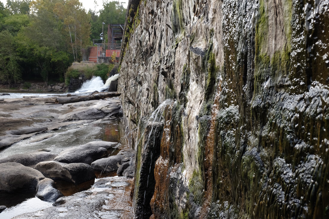
For a structure built during the 1850s, there are very few leaks in the dam itself (photo right). Restoration Systems has an informational website about the project that includes an EarthCam focused on the site, so you can watch it step by step during the next few months. |
|
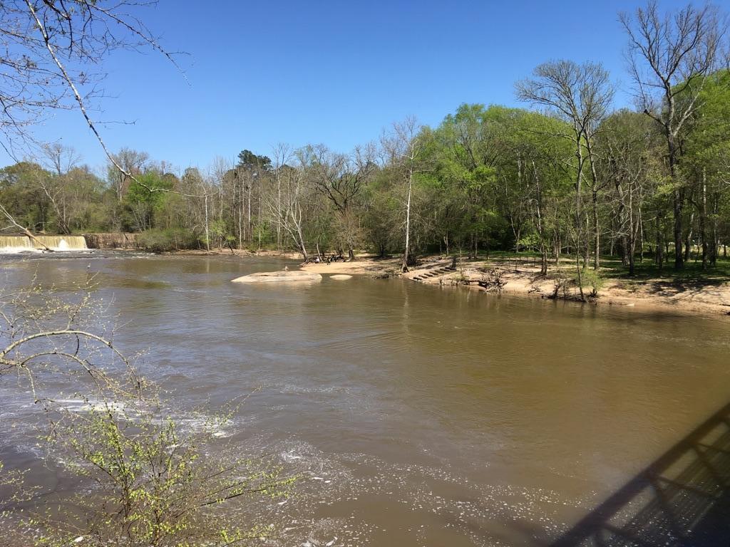
An image from the Milburnie Dam rePhoto Project , looking northeast from the bridge just below Milburnie Dam, which can be seen on the left side of the image.
Note: rePhoto is a third-party application and we can't guarantee its functionality or longevity. Report software problems directly to the rePhoto developers. |
Join the Public rePhoto Project
Repeat photography is an exciting approach to documenting change by taking repeated images from the same location through time.
Using a smartphone application called rePhoto, we established a repository of images to document the changes that will occur. We established a set of baseline images. Is there some change you'd like to document? The rePhoto app allows anyone who downloads it to align a new image with images previously taken at the same place and add that image to the repository. So download the app and contribute to the project! Please credit Robbie Holt and Colby Jones if you use any of our baseline rePhoto app images. |
High-Resolution Repeat PhotographyWe also captured high-resolution images of current conditions at more than 20 places near, downstream, and upstream of the dam.
These images show baseline landscapes in areas that we concluded would be most likely to visibly change following the dam’s removal. We considered three characteristics that suggest this potential for change: high water levels, low bank height, and proximity to the dam structure. The complete image library documenting these baseline conditions, including metadata describing the location and camera orientation for each image are available. Please credit Caitlan Britt and Laura Johnson if you use any of these baseline images. |
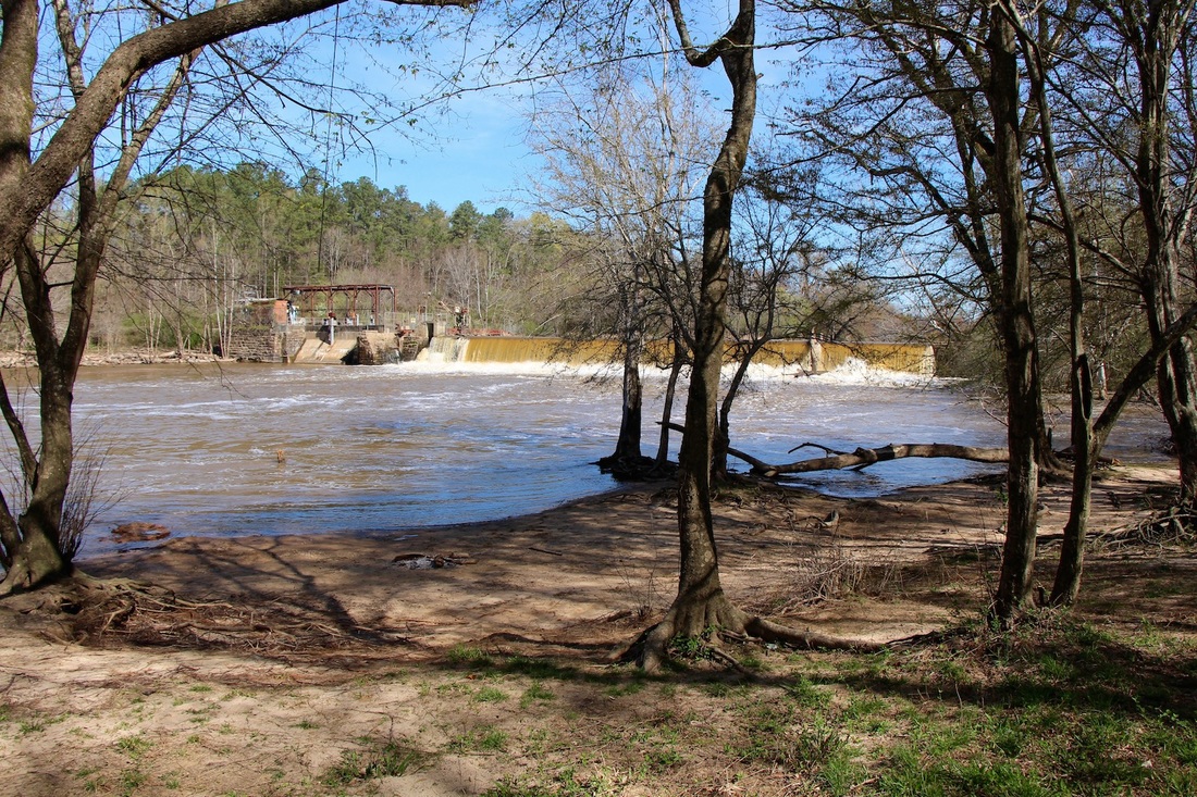
Image A2. Dam. (35.799189756, -78.539227822) Bearing 9 degrees, 4'-9.5" from ground, 18mm focal length.
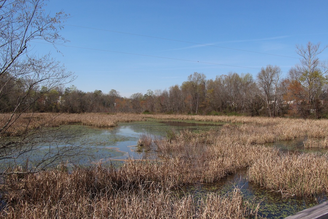
Image E2. Milburnie Wetlands (35.805142699, -78.53949578) Bearing 164 degrees, 5'-2.25" from ground, 18mm focal length.
|
This effort is a collaboration among NC State University; Raleigh Parks, Recreation, & Cultural Resources; the Nature Research Center of the NC Museum of Natural Sciences; and WakeNature Preserves Partnership. This effort is being led and conducted by students in a course on Natural Resources Measurements at NC State University.
